New Launch - India Real Estate Report 2026.

Services
Knowledge Hub
Resources
Tools

Ask Pulse Ai
©PropTech Pulse 2025, All rights reserved.


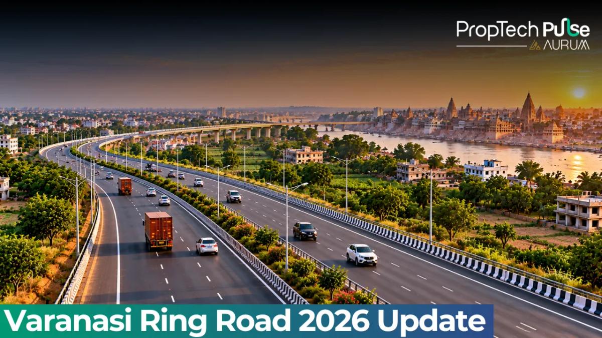
The Ring Road Varanasi route has moved from a blueprint to a functioning transit artery. Sandaha to Rewasa currently handles light traffic across the eighteen-hundred metre Ganga bridge.
Heavy trucks stay banned until the opposite lanes finish construction. Daily commuters travelling toward Gazipur now save nearly ninety minutes compared to the old gridlocked route.
Speed gains alter the investment math quickly. Buyers targeting eastern UP notice land prices along NH-31 already reflect bypass convenience. Purchasing close to the Varanasi ring road usually commands a higher upfront cost before local rental markets catch up. This guide breaks down current operations, pinpoints active bottlenecks, and explains the upcoming Varuna connector impact.
Varanasi Ring Road Route Map and Major Exits
Quick answer
The Varanasi ring road connects Harhua on the Azamgarh road to Mohansarai at the NH-19 border. It currently spans approximately fifty-nine point eight kilometres across two phases, linking NH-31, NH-56, NH-233, and NH-29 while diverting long-haul freight away from the congested city centre. Phase 2 remains partially open, allowing only light vehicles over the Ganga bridge.
Traffic management shifts significantly when vehicle volumes move onto a fresh corridor. The Varanasi bypass originates at Harhua, winds through Shivpur and Sarnath, crosses the river at Sandaha, and ends at Mohansarai. Diverting commercial freight away from the narrow arterial roads keeps bulk transport flowing east without stopping at checkpoint delays.
| Exit Name | Connects To | Distance from City Core |
|---|---|---|
| Harhua | NH-233 (Azamgarh) | West periphery |
| Sarnath | Cultural belt, NH-29 (Gorakhpur) | North-east |
| Sandaha | Ganga bridge entry, NH-31 | East of river |
| Ramnagar / Rewasa | NH-31 (Ghazipur), NH-56 (Lucknow) | South-east |
| Mohansarai (Terminus) | NH-19 (Delhi-Kolkata) | Far east end |
Investors often chase the fastest emerging plots near these junctions, especially when they want exposure to rising land values in how plot investments work in growing towns.
Sarnath attracts residential attention because it sits directly between the cultural anchor and the western terminus. If you own a logistics business, the Ramnagar exit feeds straight into the Gazipur highway, giving you direct national highway access without touching local municipal roads.
Key Junctions and Where They Lead
Commuters approaching from Lucknow via NH-56 reach the western junction at Harua first. Moving clockwise, the Sarnath interchange captures tourists and pilgrims who would otherwise clog the Lal Ghats road.
This creates immediate friction for locals trying to reach the airport or the railway station during peak holiday seasons.
Fewer developers target Rewasa than Sarnath, but strategic positioning here pays dividends later. Once fully operational, this junction handles thousands of freight tonnes daily.
Developers who secured agricultural land near Rewasa three years ago sold their holdings at steep markups once Phase 2 opened for trial movement. Buyers currently browsing Uttar Pradesh RERA registered projects check lists for new launches will notice a cluster of mid-rise towers popping up specifically to house workers stationed near these industrial feeder routes.
Beware of speculative pricing near the Sandaha bridge. Builders market flats here as river-view bypass properties, but until the heavy-lane construction completes, many sites suffer noise pollution from incomplete earth-moving equipment and restricted site access for heavy trucks.
Current Varanasi Ring Road Status (October 2026)
Registration portals update regularly, but checking actual lane availability matters more when planning a daily drive. Review the current operational status below.
Phase 1: The Fully Operational Northern Arc
November 2018 marked the official opening of this sixteen-point-five-five kilometre stretch. The four-lane asphalt performs reliably during typical monsoon seasons.
Toll collection remains minimal since this segment supports local municipal cross-linking instead of inter-state freight routes. Traffic moves freely from the university gate toward the airport exit.
Phase 2: Sandaha–Rewasa Section and the Ganga Bridge Reality
The nineteen-point-nine-eight kilometre southern extension carries a heavier price tag near nine hundred forty-nine crore rupees. Engineering challenges centre on the eighteen-hundred metre Ganga bridge standing thirty metres above water.
One full carriageway now accepts sedans and motorbikes crossing into Chiraigaon. Opposing lanes still host active construction machinery.
Traffic rules ban buses and container trucks until safety barriers cure and pavement bonds completely. Nighttime closures occasionally happen to clear debris from heavy equipment. Delivery planners should add a sixty-minute buffer during winter fog conditions near the river span.
The Varanasi Outer Ring Road Effect: Shaving Hours off Long Distances
Hauling cargo between Cantonment estates and Gazipur previously meant fighting milk tankers on narrow service roads. That twenty-kilometre trip routinely took ninety minutes. The new route cuts travel time to roughly thirty minutes on designated light-vehicle lanes.
Passenger car trips save over seventy-five minutes compared to the older urban grid. University students commuting between north and south campuses compound those yearly savings. Time reduction translates directly into lower fuel waste and faster emergency response routing.
Freight Economics and Logistics
Transport operators calculate costs differently than casual drivers. Diesel consumption drops noticeably when you eliminate stop-and-go braking patterns.
Fleet insurance premiums also decline because accident hotspots stay inside former bottleneck corridors instead of wide bypass stretches. Independent logistics yards near Mohansarai hit over eighty-two percent occupancy in just fourteen months.
The Varuna Flyover Link: Connecting the City Centre to the Bypass
The bypass stops being an isolated luxury once it connects cleanly with inner-city arteries. City authorities recently approved a forty-three-kilometre connector running parallel to the riverbank.
Priced near ten thousand nine hundred ninety-eight crore rupees, this flyover route acts as the final decongestion key.
Pulling exiting traffic straight from downtown stations removes intersection delays at oldest gates. Freight moving west or east enjoys uninterrupted flow. Municipal surface services will improve dramatically once haulage abandons street level.
Should You Invest Near These Ring Road Exits?
Targeting plots clustered near the Rewasa interchange still offers better capital growth tied to genuine Ring Road Varanasi usage.
You should avoid high-rise pushes adjacent to unfinished bridge pylons unless you plan to hold the asset for five years. Residential density spikes slowly because families prioritize school zones over raw highway proximity. Commercial tenants fill logistics yards almost overnight once construction dust settles.
Frequently asked questions
Is Varanasi ring road fully open now?
As of October 2026, the Varanasi ring road is not fully open to all traffic. Phase 1 spanning Harhua to Shivpur operates normally. Phase 2 allows only small cars and two-wheelers to cross the Ganga bridge due to ongoing heavy-lane construction. Large trucks and buses face strict bans until the second carriageway finishes.
Where does Varanasi ring road start and end?
Starting at Harhua on the Azamgarh side, the arc loops north past the AMU campus, cuts east through Sarnath, crosses the river at Sandaha, and finally terminates at Mohansarai near the NH-19 border. This layout effectively wraps around the eastern limits of the city while connecting major national highways.
How much is the cost of Varanasi outer ring road?
Project funding totals roughly three thousand four hundred crore rupees across both phases. Standard allocation covered the initial northern arc, while challenging river-crossing works in Phase 2 pushed the Sandaha-to-Rewasa segment costs up to approximately nine hundred forty-nine crore rupees alone.
Can heavy vehicles use Varanasi ring road?
State enforcement strictly prohibits trucks and interstate buses from accessing the Ganga bridge to protect temporary safety barriers still curing on the opposing carriageway. Violators face heavy fines and towing charges set by local traffic police.
What is the Varuna corridor and how does it connect to the bypass?
Sanctioned by the Central Canalisation Committee, the forty-three-kilometre flyover link runs along the riverbank. It pulls exiting traffic straight from downtown streets onto the ring road bypass, removing intersection bottlenecks and preventing surface roads from drowning in diverted highway freight volumes.
Sources
- Press Information Bureau: CCEA approval details for the Varuna Riverbank Elevated Corridor capital cost and HAM implementation model (accessed October 2026)
Enjoyed this blog article? Visit PropTech Pulse for more interesting blogs.



Ask Pulse Ai anything about real estate

Unlock the Latest in Real Estate
News, Infographics, Blogs & More! Delivered to your inbox.