New Launch - India Real Estate Report 2026.

Services
Knowledge Hub
Resources
Tools

Ask Pulse Ai
©PropTech Pulse 2025, All rights reserved.


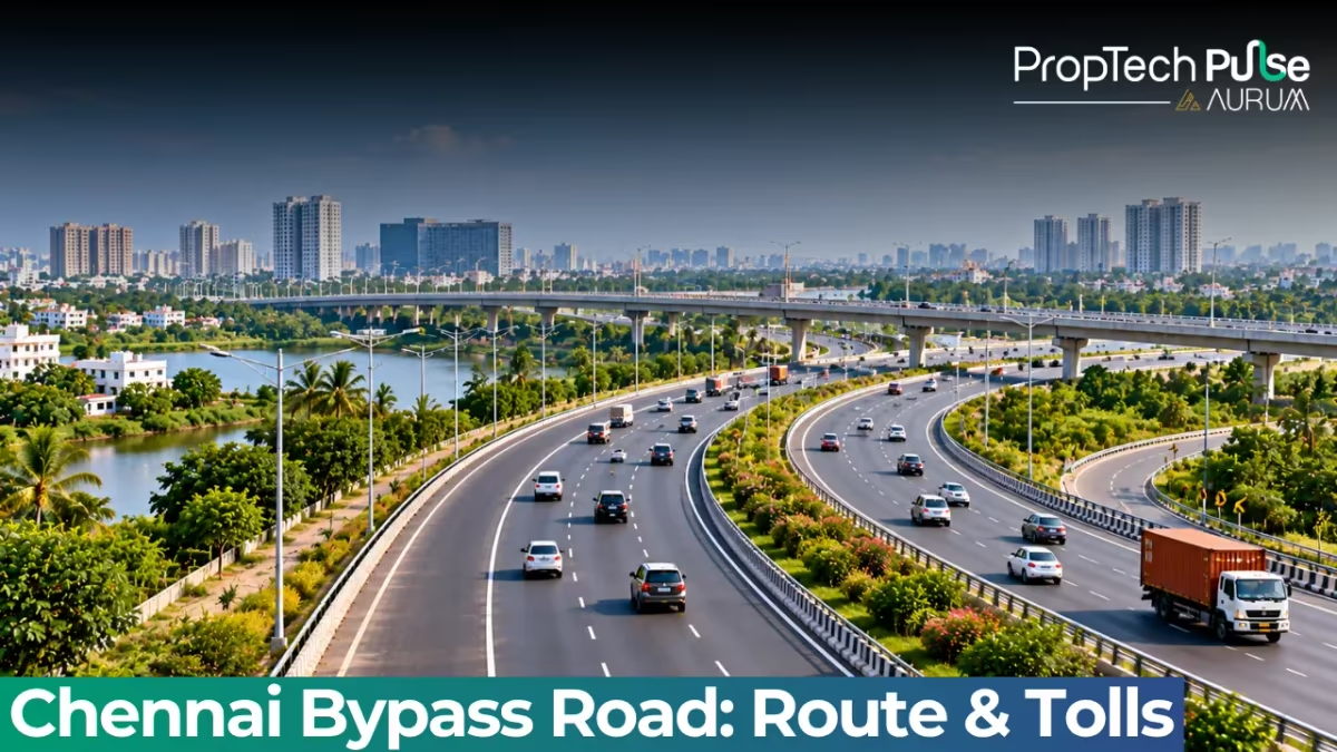
You can enter the Chennai Bypass at Perungalathur, speed past Porur and Maduravoyal, and exit at Puzhal. Pulling over mid-route remains impossible. Strict prohibitions on uncontrolled U-turns turn the city's main north-south artery into a daily logistical puzzle.
Commuters depend on scattered service roads. A brief 2 kilometre detour often stretches into a 20 kilometre maze of congested surface streets. Anyone planning to buy land or invest near this corridor needs a clear grasp of how traffic actually flows.
What is the Chennai Bypass Road?
Quick answer
The chennai bypass road is a 32 km fully access-controlled expressway connecting NH 32 at Perungalathur to NH 16 at Puzhal. Built in two phases, it handles over 55,000 vehicles daily and currently operates two active toll plazas at Surapattu and Vanagaram.
National Highways Authority of India staff manage this corridor as a core component of the East Coast Arterial Highway.
It forms part of Asian Highway 20. Planners originally built it to relieve pressure on central grids like OMR and Velachery Main Road. Traffic moves freely between southern districts and northern industrial zones here.
Most highways cut straight through residential neighbourhoods. This expressway sidesteps direct intersections entirely. Concrete dividers split the metropolitan area into separate micro-markets.
Manufacturing belts and mid-range housing anchor the western side. Residential townships grow rapidly along the Grand Southern Trunk Road to the east.
Direct visibility from the highway stays tightly controlled. Homes facing inward toward the concrete divider struggle to attract buyers. Properties bordering wider feeder roads perform significantly better. Distance to nearby entry ramps directly impacts delivery times and emergency access.
Chennai Bypass Route and Key Connections
Tracking the precise route helps investors follow nearby development projects. The expressway stays entirely within Greater Chennai boundaries while covering exactly 32 kilometres.
Builders began the alignment at a complex interchange with the Grand Southern Trunk Road at Perungalathur. The corridor sweeps northwest past Ambattur's industrial zones before reaching Maduravoyal.
Traffic never halts abruptly at Maduravoyal either. The alignment continues until merging cleanly into the Old Mahabalipuram Road corridor junction. Final integration happens directly with NH 16 at Puzhal in the far north.
Several radial arteries tap into the expressway throughout this arc. A dedicated connection to NH 48 at Ambattur opens the corridor toward Tiruvallur and Bengaluru. Overlapping sections with NH 32 further south simplify connections heading toward Puducherry.
Freight operators rely heavily on this intersection with NH 716 near Madhavaram.
The dense network makes the expressway indispensable for cargo moving between Ennore port and Krishnapatnam.
Chennai Bypass Phase 1 and Phase 2 Breakdown
Construction teams did not build this infrastructure overnight. Planners realized basic widening could never handle the early 2000s surge in private vehicles.
The NHAI divided the project into separate financial and engineering phases. Phase 1 delivered the baseline 32 kilometre carriageway. Officials opened this stretch in 2010. Initial construction introduced elevated structures specifically to navigate tight urban density.
Phase 2 targeted grade separation needs further north.
Designers extended the raised layout across the heavily congested Ambattur Industrial Estate. Engineers constructed roughly 13 kilometres of multi-lane flyovers, ramps, and interchanges.
The most complex segment anchors right here. A 3.2 kilometre six-lane structure cuts through the industrial park center.
Thousands of factory trucks now use alternate service lanes during peak hours. Buyers purchasing warehouse space alongside this zone should watch ramp completion schedules closely.
| Feature | Phase 1 (Inaugurated 2010) | Phase 2 (Under Development) |
|---|---|---|
| Core Focus Area | Purasaivakkam to Maduravoyal | Maduravoyal extending to Thiruneermalai / Ambattur Industrial Zone |
| Total Added Length | Baseline 32 km carriageway | Approximately 13 km elevated extension |
| Crossings & Intersections | Grade separation at major nodal points | Complex flyovers and interchanges across factory gates |
Chennai Bypass Tolls and Payment Updates
Driving this expressway personally exposes you to toll plazas more than once. Operators currently run two primary collection centers.
Surapattu handles the southern approach while Vanagaram processes central traffic. Axle count and vehicle category determine exact charges for every registered car or truck.
Mandatory FASTag adoption for commercial categories accelerated payment processing at both sites.
Physical infrastructure still struggles to match rising volume. Indian Highway Management Company Limited installed advanced tracking systems in the collection booms earlier this year.
Vanagaram Plaza now battles congestion from surrounding apartment complexes and retail malls.
The Greater Chennai Corporation actively pushed to move the facility away from dense zones. Officials confirmed plans to relocate the collection point toward Thiruneermalai. Heavy queues between 6 PM and 8 PM will persist until relocation wraps up.
| Toll Plaza Name | Location Relative to City | Current Operational Status |
|---|---|---|
| Surapattu Toll Plaza | South Chennai (approaching GTR) | Fully operational |
| Vanagaram Toll Plaza | Central Chennai fringe | Operational pending relocation to Thiruneermalai |
Current Commuter Restrictions and Traffic Patterns
This expressway reads perfectly on a map. Real-world commuting tells a different story. Concrete barriers block the edges with virtually no slip roads.
Legal access stays locked behind specific service lanes at Ambattur, Patravakkam, Maduravoyal, and Madhavaram. Drivers routinely cover extra kilometres just to locate a legal ramp.
Scarcity of ramps fuels widespread illegal U-turns. Night driving grows particularly hazardous because of this pattern. Motorcycle riders absorb the highest injury risk.
Local police record over 140 serious accidents annually across the 32 kilometre stretch. Fatalities reach nearly 170 every seven years.
The NHAI initially proposed a dedicated motorcycle lane to isolate two-wheelers from heavier traffic. Officials scrapped that concept in May 2024. Engineers warned that separating smaller bikes would likely trigger dangerous speeding trends and deadlier crashes.
Public transit options face identical restrictions. The Metropolitan Transport Corporation buses originally faced a complete highway ban due to missing bus stops. Private cars and freight transport absorbed the displaced volume.
Regulators partially lifted that prohibition in January 2024. Large commuter coaches still avoid the raised structure entirely. Most operators stick to wider parallel surface roads where parking rules stay predictable.
Investing Near the Chennai Bypass: Opportunities and Risks
Living close to this infrastructure delivers mixed returns for real estate buyers. Steady daily traffic above 55,000 vehicles confirms robust commercial demand.
Cold storage facilities and logistics hubs naturally settle along this corridor. These operations depend heavily on fast NH 48 access. Industrial fringe properties typically secure higher business rental yields.
Cargo operators continuously hunt for land within a five-kilometre ring. They require immediate NH 48 access for pan-India distribution networks.
Residential plots here start cheaper per square foot. Renting those same parcels to logistics firms generates faster cash recovery than standard apartments.
Never skip the environmental audit before signing long-term leases. Persistent noise and dust from heavy trucks degrade residential comfort scores significantly.
Residential purchases face entirely different constraints. Houses pressed against the sound barrier endure constant noise pollution and zero backyard privacy.
Frequent motorcycle collisions overwhelm nearby emergency clinics and trauma centres.
Capital-focused buyers frequently miss planned Bus Rapid Transit System upgrades. Planners want to install a raised rail track along the Phase 2 median. Approved construction would permanently shadow view corridors for nearby towers. Improved transit access replaces lost daylight views.
Scrutinize western industrial belt plots before committing funds. Cross-reference new connectivity maps with top 10 real estate companies in Chennai to verify they grasp local zoning limits. Developers must strictly follow Tamil Nadu RERA regulations. These rules enforce mandatory safety setbacks from high-speed roads.
Factor in updated tamil nadu stamp duty and registration charges before running final acquisition math. Budget cushions protect against sudden municipal fee revisions.
Before You Commit to a Plot or Commute Plan
This expressway operates as a geographic divider rather than a community connector. Measure exact distances to legal service road entrances before signing lease deeds or booking commute plans. Half a kilometre versus two kilometres from a proper ramp changes everything.
Peak gridlock shifts commutes by fifteen to forty-five minutes depending solely on ramp proximity. Municipal approval boards also update transit medians and toll relocation plans regularly. These infrastructure tweaks reshape traffic patterns and reset property valuations instantly.
Frequently asked questions
What is the total length and route of the Chennai bypass road?
The Chennai bypass road spans approximately 32 kilometres. It runs from Perungalathur on the Grand Southern Trunk Road in the south to Puzhal on the old coastal highway. Traffic flows through Maduravoyal and Ambattur sectors en route.
How many toll plazas are there on the Chennai bypass, and which ones are open?
There are currently two active toll plazas operating on the expressway. The Surapattu plaza sits near the southern limit, while the Vanagaram plaza handles central traffic. The Vanagaram center faces urgent plans to relocate deeper into the Thiruneermalai zone to ease ongoing congestion.
Why does the Chennai bypass get so many traffic jams despite being an expressway?
Gridlock occurs because the expressway stays fully enclosed. Drivers searching for shortcuts frequently attempt illegal U-turns. Many waste hours circling to find the handful of permitted ramps at Ambattur or Maduravoyal.
Can public buses travel on the Chennai bypass road right now?
The Metropolitan Transport Corporation faced a total highway ban due to missing bus stops. Regulators partially lifted that restriction in January 2024. Large buses still prefer wider parallel surface roads to avoid complex highway rules.
Will there be a dedicated two-wheeler lane added to the Chennai bypass?
Engineers proposed isolated motorcycle lanes decades ago. National Highways Authority officials shelved that blueprint in May 2024. They concluded that segregating bikes would accidentally encourage dangerous speeding and trigger deadlier crash patterns.
Sources
- National Highways Authority of India (NHAI): Project details and phase breakdowns regarding the East Coast Arterial Highway access control (accessed October 2026)
- Ministry of Road Transport and Highways: Baseline data on Asian Highway 20 corridor integration and national highway numbering (accessed October 2026)
- Government of India - Department of Infrastructure: Official records on national highway maintenance standards and toll policy frameworks (accessed October 2026)
Enjoyed this blog article? Visit PropTech Pulse for more interesting blogs.




Ask Pulse Ai anything about real estate

Unlock the Latest in Real Estate
News, Infographics, Blogs & More! Delivered to your inbox.