New Launch - India Real Estate Report 2026.

Services
Knowledge Hub
Resources
Tools

Ask Pulse Ai
©PropTech Pulse 2025, All rights reserved.


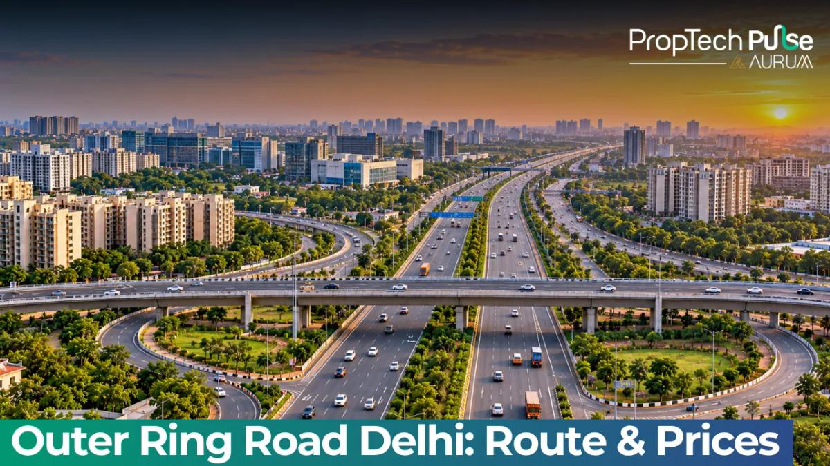
Moving away from Central Delhi usually means trading proximity for space. Yet the Outer Ring Road Delhi has quietly rewritten that trade-off.
Spanning roughly 47 kilometers, it functions as a high-speed spine rather than a simple boundary. Premium residential hubs, industrial parks, and transit arteries link directly along its route.
Families priced out of the center and investors chasing yields finally find a structured middle ground here. The trade-off between commute time and living space has shifted dramatically along this corridor.
Why the Outer Ring Road Shapes Modern Delhi Living
Understanding the Outer Ring Road Delhi length and core structure
Originally conceived to divert traffic, the Outer Ring Road now drives capital expansion. It typically features a six-lane divided carriageway capped at 60 km/h.
Fourteen major interchanges act as reliable transfer points to state highways, while travelers heading to Gurugram or Noida easily skip the bottleneck delays plaguing radial roads. The design favors flow, making this one of the most predictable routes in the NCR.
Quick answer
The Outer Ring Road Delhi spans approximately 47 kilometers, operating as a six-lane controlled-access bypass with a 60 km/h speed limit and over a dozen major interchanges. It links high-density premium hubs to emerging transit nodes, offering predictable commutes and strong rental liquidity for well-located apartments.
The infrastructure does double duty. Beyond easing congestion, it funnels commercial development toward the periphery.
Warehousing, integrated business parks, and mid-tier retail complexes cluster tightly around interchange knots.
Those employment hubs generate steady local housing demand without forcing residents into the crowded central business districts. Workers simply live closer to where the jobs actually sit.
Buying tip: Always check the carpet area against the built-up area in brochures. Perimeter towers vary in common-space ratios based on the builder’s phase and approvals.
The Complete Delhi Outer Ring Road Route (Quadrant-by-Quadrant)
Breaking down the delhi outer ring road route into directional segments clarifies where specific buyer profiles fit best. The road does not serve a single demographic; rather, it hosts four distinct market characters.
West & Southwest: Dwarka, Najafgarh to RK Puram & Panchsheel Park
Prices hit their highest tier in this zone. Affluent neighborhoods like RK Puram and Panchsheel Park anchor the southern arc with mature trees, wide roads, and scarce new supply.
Westward, Dwarka transitions into modern towers targeting corporate professionals near the International Terminal. Najafgarh marks the affordable fringe where larger independent homes still trade below neighboring prices.
South & Southeast: Badarpur, Kalkaji, Okhla Industrial & Residential belts
Clockwise from there, the road cuts through dense residential grids. Kalkaji and South-extension adjacent zones provide immediate access to central metro connectivity while maintaining lower entry prices than the southwest.
Okhla Phase 2 and 3 function as a hybrid belt, blending worker housing with sprawling logistics warehouses. Buyers prioritizing liquidity and quick exit options gravitate toward this sector due to constant tenant demand.
East & Northeast: Mayur Vihar, Krishna Nagar to Shahdara
Farther north and east, the corridor mirrors historical expansion toward the Yamuna floodplains. Mayur Vihar offers high-rise density near educational hubs, while Krishna Nagar and Ghitorni sit at the intersection of rapid transit upgrades and heritage low-rise colonies.
Shahdara marks the extreme eastern terminus of the residential overlay, catering largely to first-time buyers navigating budget constraints near manufacturing units.
North & Northwest: Aliping, Rohini, Pitampura, Model Town & Azad Pur
Wrapping back to the northwest, we find Delhi’s oldest planned micro-markets. Rohini’s sector-wise layout and Pitampura’s commercial strips support self-sustaining ecosystems.
Azad Pur and Model Town host high-volume secondary transactions driven by migration from central wholesale markets. These localities trade on convenience, school catchments, and decades-old civic maturity rather than speculative new-build premiums.
Decoding Property Rates Across Key Zones
Assessing the Outer Ring Road Delhi localities requires looking beyond the address itself.
Baseline valuations fluctuate heavily based on building age, society maintenance standards, and distance to the nearest railway or metro stop. The following framework illustrates how capital typically allocates across the primary trading corridors.
| Quadrant / Locality | Price Tier Profile | Typical Buyer Profile |
|---|---|---|
| West & Southwest (Panchsheel Park, RK Puram) | Premium / Ultra-high end | Senior executives, legacy residents |
| Central Arc (Kalkaji, Mayur Vihar, Tagore Garden) | Mid to upper-mid tier | Cross-commuters, young families |
| Southeast Fringe (Okhla Phase 2, Ghitorni) | Value-driven mid tier | Investors targeting rental yield |
| Far East & West Ends (Shahdara, Najafgarh) | Entry-level / Transitional | First-time purchasers, budget buyers |
| Northern Belt (Rohini, Pitampura, Azad Pur) | Established stable tier | Mature families, government staff |
A 1,000-square-foot apartment at ₹45,000 per square foot totals ₹4.5 crore. Municipal taxes and society maintenance fees run separately. You can plug current interest rates into a home loan EMI calculator to gauge your monthly cashflow before signing anything. Cross-reference asking prices with actual sale deeds from comparable societies instead of trusting listing portals.
Transit Reality: How Outer Ring Road Delhi localities Connect to Metros & Highways
An arterial road is only as valuable as the veins feeding it. The corridor succeeds because it rarely sits isolated from mass transit.
Intersecting Metro Networks (Violet, Magenta, Pink, Airport Express)
Three main metro lines cut across the corridor at key interchange points. The Violet Line hits the western and northern edges near Dwarka.
The Magenta Line threads through Janakpuri West and Patel Chowk, funneling northwest residents into the financial core. The Pink Line spans the city sideways from Shaktinagar to Majlis Park, bypassing downtown entirely.
Highway Linkages (NH-48, NH-44, NH-24)
Drivers relying on surface routing still benefit from close parallels to critical national corridors.
NH-48 carries traffic toward Gurugram and the airport via the Dwarka Expressway merge point. NH-44 tracks the southern arc, routing vehicles straight toward Faridabad and Mathura. NH-24 branches east toward Ghaziabad, handling most commercial freight movement. That network design guarantees redundancy for both freight and passenger lanes whenever a segment shuts down for maintenance.
Upgrading the Corridor: Infrastructure Projects Changing Values
Government interventions continuously reshape the daily experience of traveling the Outer Ring Rd. Signal removal at historically jammed knots has compressed average trip durations by nearly fifteen percent over the last few years.
Pedestrian underpasses, signal removal, and EV charger rollout
Municipal engineering teams have systematically deployed pedestrian underpasses at notorious pinch points, including IIT Delhi, Khel Gaon, Chirag Delhi, and Nehru Place.
These structures separate vulnerable road users from heavy two-wheelers and buses, dramatically reducing jaywalking accidents. Public works departments are also rolling out standardized EV charging bays along service roads.
Those spots support the growing number of electric delivery vehicles serving nearby warehouses.
Impact of the Signature Bridge on Eastern connectivity
The newly operational signature cable-stayed bridge over the Yamuna has fundamentally altered eastern logistics. Commuters heading toward Noida, Greater Noida, and eastern Uttar Pradesh no longer queue for extended periods at major river crossings.
This lateral relief pushes the effective radius of the Outer Ring Road eastward, revitalizing previously stagnant transit-oriented developments that now register meaningful pre-launch interest.
Final Verdict: Where to Allocate Capital in 2026
The strongest purchasing logic aligns budget flexibility with transit proximity. Reserve capital for buildings located within a walking distance of an active interchange station on the Violet, Magenta, or Pink lines.
Avoid properties trapped behind unreplaced signals or lacking proper RERA clearance, regardless of how attractive the brochure pricing appears. Before advancing any token amount, verify project listings on the RERA state: delhi portal to confirm builder track records. Prioritize liquid floor plans over unique architectural gimmicks, and let verified transaction comps dictate your negotiation ceiling rather than seller expectations.
Frequently asked questions
How long is the Outer Ring Road in Delhi?
The corridor spans approximately 47 kilometers around the metropolitan perimeter. Designed as a continuous bypass route, it connects diverse districts ranging from Najafgarh in the southwest to Shahdara in the northeast. Planning your daily commute requires accounting for the full circumference, which effectively bypasses the congested central zones while linking peripheral growth corridors directly to the broader highway network.
Which areas are connected by the Outer Ring Road in Delhi?
It stitches together prominent residential clusters, including Dwarka, Pitampura, Rohini, Model Town, Azad Pur, Kalkaji, Okhla, and Mayur Vihar. Beyond housing societies, the roadway also functions as a logistics lifeline for several large-scale commercial and industrial parks scattered along its trajectory. These neighborhoods rely on the ring road to maintain steady access to central transit nodes without entering inner-city gridlock.
How is Outer Ring Road connected to Delhi Metro?
Three primary metro lines intersect the corridor to create vital interchange stations. The Violet Line anchors the western and northern stretches, while the Magenta Line threads through Janakpuri West and Patel Chowk. Cross-city travel happens via the Pink Line, which spans from Shaktinagar to Majlis Park and keeps peripheral residents linked to rapid rail access.
Is buying property on Outer Ring Road a good idea in 2026?
Investing along the corridor suits commuters prioritizing predictable travel times over central location premiums. Properties situated within one kilometer of existing metro stations tend to demonstrate stronger resale liquidity and consistent rental demand. However, buyers must independently calculate their monthly repayment capacity beforehand and validate that developers hold active RERA approvals to avoid legal complications during possession.
Sources
- Delhi Metro Rail Corporation official route maps: Network connectivity and station alignment data (accessed October 2026)
- National Highways Authority of India database: Corridor mapping and national highway merger specifications (accessed October 2026)
Enjoyed this blog article? Visit PropTech Pulse for more interesting blogs.


Ask Pulse Ai anything about real estate

Unlock the Latest in Real Estate
News, Infographics, Blogs & More! Delivered to your inbox.