


SVAMITVA (Survey of Villages and Mapping with Improvised Technology in Village Areas) is a Central Sector Scheme launched by the Ministry of Panchayati Raj to provide legal ownership records for residential properties in rural India. By using drone technology and Geographic Information System (GIS) mapping, the initiative aims to create accurate digital records of village properties and issue property cards to eligible owners. The programme addresses one of rural India's long-standing challenges, where many residential properties lacked formal ownership records, often leading to disputes and limited access to institutional finance.
Under the scheme, high-resolution drones survey inhabited village areas, capturing detailed aerial imagery that is processed into digital maps. These maps are verified with the participation of local authorities and residents before property boundaries are finalised. Once the verification process is complete, eligible property owners receive official property cards that serve as legal records of ownership. The technology-driven approach replaces traditional manual surveys, improving both the accuracy and transparency of rural land records.
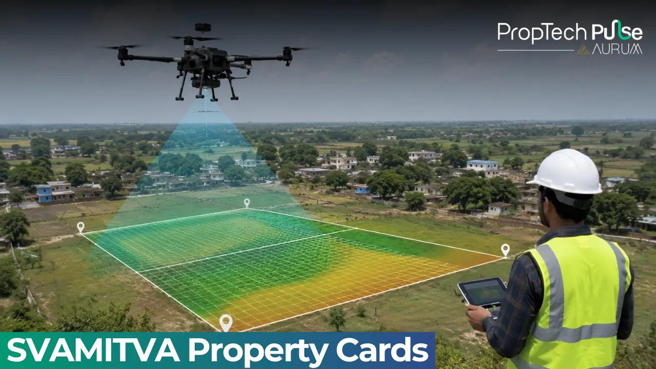
How Drone Surveys Improve Land Records
Drone surveys have significantly reduced the time required to map rural settlements while improving measurement accuracy. Unlike conventional land surveys, drones capture detailed spatial data that helps clearly identify property boundaries and minimise overlapping claims. The digital maps generated under the scheme are integrated with GIS platforms, allowing authorities to maintain updated land records and support better village planning.
The scheme also strengthens governance by creating a reliable digital database that can be used by various government departments for infrastructure planning, property taxation where applicable and rural development programmes. The availability of standardised digital maps improves coordination between revenue authorities, Panchayats and planning agencies.
Benefits for Rural Property Owners
One of the biggest advantages of SVAMITVA is that it provides rural homeowners with recognised proof of property ownership. Property cards can help individuals use their residential assets as financial assets, enabling easier access to bank loans and other financial services offered by lending institutions. Clear ownership records also help reduce disputes arising from unclear or undocumented property boundaries.
The initiative supports broader rural development by improving transparency in land administration and giving village residents greater confidence in property transactions. Digital ownership records also make it easier for authorities to prepare village development plans using GIS-based data, contributing to more efficient infrastructure planning and public service delivery.
- Uses drone technology for village property surveys.
- Issues legal property cards to eligible rural homeowners.
- Creates accurate GIS-based digital land records.
- Helps reduce property-related disputes.
- Supports access to institutional credit and financial services.
Progress of the SVAMITVA Scheme
The scheme has expanded steadily since its launch in 2020. According to the Ministry of Panchayati Raj, drone surveys have been completed in more than 3.20 lakh villages, while over 2.42 crore property cards have been created across 1.61 lakh villages. The initiative has also been showcased internationally as an example of technology-driven land governance and rural digitisation.
By combining drone technology, GIS mapping and digital property records, SVAMITVA is modernising rural land administration across India. The scheme not only provides legal ownership documentation to millions of rural households but also strengthens financial inclusion, improves governance and supports long-term village planning through reliable and transparent property records.
Enjoyed this update? Visit PropTech Pulse for more real estate news, investment insights, and property market trends.


