New Launch - India Real Estate Report 2026.

Services
Knowledge Hub
Resources
Tools

Ask Pulse Ai
©PropTech Pulse 2025, All rights reserved.


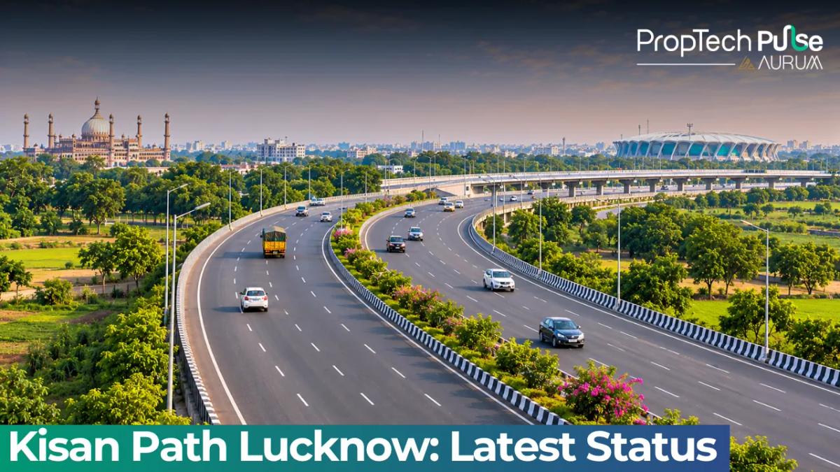
If you drive past the eastern suburbs today, the grade-separated stretch known as Kisan Path Lucknow dominates the skyline.
For logistics fleets and daily commuters, the critical question is readiness. As of October 2026, the main eight-lane carriageway operates freely, while crew finish lighting and interchange ramps through December.
This corridor quietly reshapes access between the state capital and Barabanki.
It also shifts investor focus toward plots near Sultanpur Road and Dewa Road. Below is a verified breakdown of open sections, lingering hold-ups, and exact speed rules.
What Is Kisan Path? (vs the Lucknow Outer Ring Road)
Quick answer
Kisan Path is an 11 km access-controlled connector that forms part of the larger 104 km Lucknow Outer Ring Road (NH-230). The Lucknow Outer Ring Road runs a complete dual-carriageway loop around the city. Kisan Path specifically handles heavy east-west traffic, linking the Sultanpur Road corridor directly to the Faizabad and Raebareli road junctions.
The naming causes confusion because news reports and local real estate listings swap the two terms.
The Lucknow Outer Ring Road covers the full 104 km loop developed under NHAI jurisdiction to relieve intra-city congestion. Kisan Path represents the eastern slice of that network.
Builders designed it for fast truck movement and direct exits into the eastern industrial pockets. The broader highway package cost roughly ₹4,600 crore under MoRTH regulation, which keeps both names attached in transit planning.
Lucknow Outer Ring Road Status Today
Checking the current construction phase requires separating the main highway lanes from the connecting ramps.
The National Highways Authority of India tracks progress using Package Completion Certificates and Complete Completion Certificates.
Completed Packages and Open Carriageways
A PCC means the contractor handed over the main asphalt and concrete barriers. A CCC confirms every peripheral element including drainage and service roads reached completion.
The primary eight-lane carriageway stands fully open from the Rajajipuram interchanges straight to the Barabanki district boundary.
Heavy vehicles and private cars routinely traverse this stretch without encountering unfinished surfaces. Major grade-separated intersections like the Sultanpur Road crossing clear their top decks for normal traffic flow.
What's Still Being Built (Service Lanes & Signage)
Wide-open main lanes sit beside active grading zones. Linear service roads flanking the eastern stretch await final lighting installations and guardrail welding.
Crews target eighty percent operational capacity along the feeder roads by late October 2026. Temporary detours appear near Sikandra and the Indira Nagar extension as contractors place smart ramp signage. Expect brief night-shift closures until the final CCCs drop.
Driver Tip: Keep your left side reserved for overtaking on the main deck until the mid-section service roads get fully paved. Using the shoulder for quick stops invites heavy fines under the new traffic monitoring cameras.
Lucknow Ring Road Route: Junctions and Highway Connections
The strategic value of this corridor lies in how it stitches together disconnected arterial roads. Drivers now bypass dense commercial hubs entirely instead of fighting gridlock through Vidhan Sabha or Hazratganj.
Here is the sequence of major connections moving clockwise from the western entry point down to the Kisan Path segment:
- NH-24 (Delhi-Kolkata): Major interchange handling Delhi-bound freight traffic.
- NH-25 (Lucknow-Kanpur): Direct link towards the Kanpur industrial belt.
- NH-28 (Lucknow-Gorakhpur): Critical northern gateway connecting to eastern UP.
- NH-30 (Lucknow-Jaunpur): Facilitates travel towards Varanasi and Mughal Sarai rail terminals.
- NH-56 (Ghaziabad-Lucknow): Bridges the gap back towards the NCR region.
Logistics operators running routes around Kisan Path in Lucknow quickly notice how the eastern anchor point divides.
The connector branches into Faizabad Road toward Ayodhya and Raebareli Road. Trucks avoid narrow urban streets carrying high-value goods entirely.
Commute Impact: Distance Saved and Toll-Free Transit
Before this corridor existed, a trip from the northern industrial belts to Barabanki easily consumed seventy to ninety minutes. Unsignalized crossings and bottleneck turns ate hours off schedules.
Using the new configuration cuts daylight travel time by more than thirty-five minutes. Covering the eleven kilometre Kisan Path segment at a steady eighty kilometres per hour takes roughly ten minutes.
Surface roads still trap you at multiple signals. Those trips routinely consume half an hour even on quiet mornings. Zero toll plazas mean lower transaction fees and better fuel economy from reduced idle stops.
Traffic Rules, Speed Limits and Camera Enforcement
New roads bring stricter enforcement, and Uttar Pradesh Police upgraded its Traffic Monitoring Camera System to match higher allowed speeds.
Light vehicles including personal cars and small commercial vans cap at one hundred kilometres per hour on wider stretches.
The Kisan Path zone enforces an eighty kilometre limit to account for frequent eastern exits.
Heavy vehicles face tighter restrictions. Pickup trucks and container lorries must stay at sixty kilometres per hour on the connector itself.
The rolling TMCS rollout deployed in March 2026 processes over thirty thousand vehicles daily. Gantry units snap images at designated checkpoints and feed directly into the digital challan system.
| Vehicle Category | Lucknow ORR (General Stretch) | Kisan Path Segment |
|---|---|---|
| Light Vehicles (Cars, Vans, Motorcycles) | 100 km/h | 80 km/h |
| Heavy Vehicles (Trucks, Buses, Lorries) | 80 km/h | 60 km/h |
Dodging camera gantries on unpaved shoulders risks suspension damage and automatic penalty issuance. The digital enforcement grid covers the entire accessible length.
Commercial Growth and Plot Absorption Near the Connector
Warehouses and cold-storage facilities are flocking to the eastern arc. Availability of wide, uninterrupted frontage along Kisan Path Lucknow makes this stretch ideal for last-mile delivery hubs feeding North Indian markets.
Logistics firms prioritize sites within a five kilometre radius of the NH-24 interchange to minimize drayage times.
Residential plots track the commercial shift. Brokers report that asking rates for corner plots near Sikandra and Teliyarganj have climbed steadily since the main carriageway opened.
Buyers chasing lower ticket prices often overlook the fact that infrastructure maturity drives rental yields. Areas lacking direct on-ramps to the connector still struggle to attract tenants.
Municipal development follows the highway closely. The Nagar Nigam has widened approach roads leading onto Kisan Path in phases, though peak-hour queueing remains common during monsoon months.
Watch for upcoming zoning updates that could permit mixed-use commercial buildings on agricultural land adjacent to the service lane. Checking UP RERA compliance for ongoing township projects remains essential before committing funds.
Why the Eastern Corridor Matters for Investors
Property developers historically treated Lucknow's eastern half as secondary to the north-south prime axis. Opening this ring road fundamentally alters land valuation metrics for buyers exploring areas near Lucknow Kisan Path. Plots sitting within a two kilometre radius of completed flyovers now command premium rates because rapid market access arrives upfront.
Existing homeowners face mixed outcomes. Central city noise pollution drops significantly. Localized traffic density rises near housing societies planning frontage on feeder roads. Investors should track rental yield trends alongside the Lucknow Outer Ring Road route status investment guide. Map appreciation hotspots now, before final CCC paperwork closes next quarter.
Before You Plan Your Next Move
Use the main carriageway for point-to-point commutes across districts. Reserve newly completed service lanes for accessing upcoming retail plazas and township entrances.
Double-check railway overbridge height clearance if you operate tall logistics vans. Keep registration details updated to avoid automated e-challans from the TMCS system.
Frequently asked questions
Is Kisan Path and Lucknow Outer Ring Road same?
Not quite. Kisan Path covers only the eleven kilometre eastern connector built for fast truck movement. The Lucknow Outer Ring Road spans the full one hundred four kilometre dual carriageway loop. Together they form a massive bypass, but the connector functions as the dedicated eastern leg.
How long is Kisan Path Lucknow?
Eleven kilometres mark the dedicated segment. It runs from the Sultanpur Road interchange through eastern suburbs and touches the Ambedkar Nagar boundary near Barabanki. Add this stretch to the remaining ninety three kilometre loop for total circumferential mileage.
Is Kisan Path Lucknow fully open now?
Eight lanes run continuously for public and commercial traffic. You can drive the full length without hitting unfinished patches. Construction crews wrap parallel service roads, install street lights, and weld final guardrails before November ends.
What is the speed limit on Kisan Path Lucknow?
Passenger vehicles cap out at eighty kilometres per hour on the connector. Heavy trucks and buses face stricter limits of sixty kilometres per hour to manage safety across frequent exits. Wider loop sections allow higher speeds based on weight classes.
Where does Lucknow ring road connect to Ayodhya road?
Faizabad Road picks up exactly where the connector ends. After traversing the eleven kilometre access-controlled stretch, the corridor splits southward toward Ayodhya and branches onto Raebareli Road. Drivers get clean alternatives without touching crowded municipal streets.
Sources
- National Highways Authority of India (NHAI): Project dashboard and package completion certificates data (accessed October 2026)
- Uttar Pradesh Police: Current speed norms and traffic violation enforcement protocols (accessed October 2026)
- Ministry of Road Transport and Highways (MoRTH): National highway policy framework and toll-free transit classifications (accessed October 2026)
- Uttar Pradesh Real Estate Regulatory Authority (UP RERA): Development compliance standards for infrastructure-adjacent projects (accessed October 2026)
Enjoyed this blog article? Visit PropTech Pulse for more interesting blogs.





Ask Pulse Ai anything about real estate

Unlock the Latest in Real Estate
News, Infographics, Blogs & More! Delivered to your inbox.