New Launch - India Real Estate Report 2026.

Services
Knowledge Hub
Resources
Tools

Ask Pulse Ai
©PropTech Pulse 2025, All rights reserved.


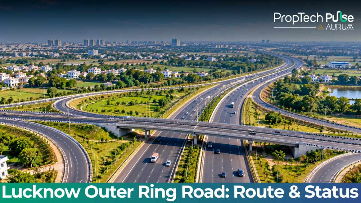
The Lucknow Outer Ring Road has completed its final stretch, turning a years-long construction project into a fully operational circular highway as of early 2026.
For commuters and investors alike, the physical infrastructure is finally set, shifting the conversation from broken ground to finished asphalt. The loop changes how people move across the city and drastically alters land valuations across multiple suburbs.
This guide covers the corridor's current operational status. It maps the exact route and exit points, then breaks down the specific real estate implications for homebuyers and commercial investors targeting the Lucknow market.
You will find actionable data on which micro-markets are poised for appreciation and what the infrastructure actually means for your daily commute and property portfolio.
Current Status of Lucknow Outer Ring Road
Quick answer
The 104 km Lucknow Outer Ring Road, officially designated as NH 230 and branded as Kisan Path, opened to public traffic following its inauguration in March 2026. Designed by NHAI, the corridor runs an 8-lane dual carriageway. Width expands to 10 lanes at major intersections, creating a reliable bypass around the northern capital of Uttar Pradesh.
The project was executed in phases over several years to manage disruption while linking critical industrial zones and suburban clusters.
Completion of the approach roads in early 2026 marked the transition from fragmented construction zones to a continuous circular movement network.
It is not merely a perimeter track; the corridor acts as the primary arterial spine, diverting heavy freight and passenger vehicles away from the congested core.
Daily vehicle capacity reaches roughly 1.6 lakh, reducing pressure on legacy routes like the Gomti Expressway and older Kanpur alignments. Minor finishing work and signage updates continue in the months following inauguration.
Residents inside the new boundary get immediate access upgrades, while commuters outside mark a permanent shift in Lucknow’s urban footprint.
Detailed Lucknow Ring Road Route and Connectivity
Understanding the layout requires mapping how the alignment connects to existing national and state highways.
The loop spans roughly 104 kilometres, wrapping around Lucknow district and dipping slightly into Barabanki and Amethi, though the primary impact zone stays within municipal limits.
Aligning the 104 Km Corridor
Design priorities focus on uninterrupted flow rather than dense interchanges at every village. Entry and exit points sit at strategic intervals that allow regional traffic to merge cleanly.
The corridor functions as NH 230, ensuring long-term maintenance funding and federal-level governance instead of relying solely on state budgets.
Major Junctions and Highway Connections
A functioning bypass must connect to the broader transport grid. The Lucknow ORR achieves this by intersecting five national highways and six state highways, creating logical hubs for logistics, warehouses, and distribution centres. Plots at these junctions command premium rates compared to sites ten kilometres off track.
Physical Structure: Lane Count, Flyovers, and Entry/Exit Points
Engineers planned structural specs for future-proofing rather than immediate demand. At major choke points, such as the intersections with Sultanpur Road and Sitapur Road alignments, the width expands to ten lanes.
Widened segments sit beneath extensive flyovers, underpasses, and railway bridges designed to eliminate signal stops along the route. The base configuration runs eight lanes across the dual carriageway.
| Metric | Specification |
|---|---|
| Total Length | 104 km circular loop |
| Carriageway Width | 8 lanes (expanding to 10 at major intersections) |
| Daily Vehicle Capacity | Approximately 1.6 lakh vehicles |
| Connecting National Highways | 5 direct interchanges |
| Structural Assets | Multiple flyovers, underpasses, and railway bridges |
| Project Execution Agency | National Highways Authority of India (NHAI) |
Budgets scaling this high guarantee a toll-free or economically viable corridor for decades. Surrounding land becomes a far more stable asset class.
Strategic Real Estate Nodes Along the Kisan Path Lucknow Route
Investment logic along a ring road differs completely from city-centre rules. Core locations charge premiums for established amenities and density, whereas the ORR charges for future potential and accessibility instead. Specific corridors offer distinct advantages depending on whether you buy residential carpet area or commercial warehouse space.
Sultanpur Road and Wellness City Axis
This eastern quadrant connects heavily with the upcoming wellness city developments and IT expansions.
Plots near the ORR interface on the Sultanpur side are seeing aggressive price adjustments because they sit at the intersection of two high-growth zones.
The proposed expansion of the dedicated IT and precision electronics park nearby acts as a magnet for young professionals, driving up demand for gated communities with clubhouses and schools.
Land that sold for roughly ₹15 lakh per biswa a few years ago now commands significantly higher rates due to this clustering effect.
Sitapur Road and Industrial Linkages
Evaluating land for manufacturing or cold storage makes the Sitapur Road exit a clear winner. Power grids and water pipelines run parallel to the older rail lines here, creating a prime location for B2B showrooms receiving materials overnight.
Kanpur Road and Logistics Density
The western connection drives hard goods towards Delhi and Jharkhand. Land adjacent to the Kanpur Road interchange is rapidly transforming from farmland to logistics parks, offering reliable footfall from trucks and corporate fleets. real estate developers in Lucknow are actively acquiring large tracts here for mega-planned communities that cater to corporate executives relocating for these supply chain roles.
Ayodhya Road and Eastern Growth
The southern and eastern trajectories benefit from religious tourism combined with administrative decentralisation. Properties here command steady appreciation alongside government dispersal of ministries and satellite offices outward, making it a safer option compared to the explosive growth on industrial axes.
Navigation tip Even with the loop closed, many local village roads leading to specific plots remain narrow during monsoon months. Always drive the exact entrance road during heavy rain before committing to a site visit. What looks wide on a dry map can turn into mud quickly on unpaved service stretches.
Impact on Property Prices and Commercial Viability
Opening a ring road invariably creates a wave of speculation, followed by reality-based valuation corrections.
Within the first few months of the Lucknow ORR becoming fully operational, land bank valuations in the fringe villages jumped by double-digit percentages.
Residential projects launching near the new exits are marketing heavily on commute times.
A flat located four kilometres off the ORR exit typically sees a twenty per cent premium over comparable units sitting closer to the old city limit, helping professionals avoid the two-hour city traffic slog to reach their desks.
Many buyers compare the ORR with the existing Gomati Expressway.
The expressway cuts diagonally across the city, offering speed but terminating abruptly at specific gateways. A continuous wrap eliminates the return-trip congestion that plagues radial roads when your destination shifts frequently.
Commercial viability tracks exactly where the flyovers are placed. Warehouses and showrooms need quick ingress and egress, meaning a plot right at the ROBs moves product much faster than one back within the inner service lane.
Factor in your inventory turnover when calculating ROI, and frontage becomes non-negotiable for active businesses.
Taking a home loan for a unit in these zones? Factor extra travel costs into your monthly budget until your workplace shifts to the corridor. You can model your financing accurately using a home loan EMI calculator before locking in a high-value mortgage.
Practical Tips for Buyers Using the Lucknow Outer Ring Road
The physical road is finished, but the surrounding ecosystems take years to mature.
Buyers looking to purchase a plot or an apartment along the Kisan Path loop must look past the glossy brochures and verify three specific things before transferring funds.
- Service Road vs Main Carriageway: Ensure the listing specifies whether you are getting a strip along the restricted-access main highway or the commercial-grade service road. You cannot buy a car at the main carriageway, but you can park safely on the service lane.
- Encumbrance Check: Rapid land acquisition waves sometimes lead to overlapping ownership claims in rural pockets. Run a full title verification and encumbrance certificate check through a local advocate before paying any token amount. Keeping track of registered builder credentials via the Lucknow Kisan Path locality guide is also essential to avoid rogue developers.
- Flooding Margins: Parts of the alignment dip close to natural drainage lines originating from the Gomti river basin. During intense July to September rainfall, low-lying plots near the service roads can retain standing water. Inspect the spot at eye level during peak monsoon to confirm the elevation matches the developer's drawings.
Verifying that a project complies with local zoning regulations prevents costly legal tangles down the line. Projects falling under the northern jurisdiction must align strictly with the master plan, so cross-referencing approved plans against the state portal removes guesswork entirely.
Before You Make a Decision
The Lucknow Outer Ring Road is no longer a promise; it is a functional reality that dictates the next decade of urban expansion in Uttar Pradesh's capital. If you are investing, match your goal to the geography.
Pick the Sitapur or Kanpur road interfaces for logistics and commercial returns, and lean toward the Sultanpur or Ayodhya road alignments for residential stability and lifestyle townships.
Do not rush into a speculative plot purchase simply because a sales agent promises rapid appreciation.
Walk the land, check the exact distance to the nearest township grocery store and hospital, and calculate your actual commute time from your current job location. Infrastructure adds value, but only if the neighbourhood develops around it to support daily living.
Frequently asked questions
Is Lucknow outer ring road completely open now?
Yes, the 104 km circular loop was formally inaugurated in March 2026, completing all final approach roads and connecting sections. While minor roadside landscaping and signposting updates continue, the highway itself is fully operational for regular and commercial traffic. Commuters can now use the entire bypass to move between key districts without entering the city limits.
What is the full route map of Kisan Path Lucknow?
The route follows the NH 230 designation and spans 104 kilometres around the northern capital. It intersects five national highways and six state highways, connecting critical zones like Sultanpur Road, Sitapur Road, Kanpur Road, and Ayodhya Road. The loop dips slightly into neighbouring districts but remains anchored within the Lucknow metropolitan planning area.
Which areas are best to buy property near Lucknow outer ring road?
Investment strategy depends on your goal. For commercial ventures like warehouses, the Kanpur and Sitapur road junctions offer superior logistics access. For residential homes seeking rapid appreciation, the Sultanpur Road and Wellness City extensions represent the strongest growth corridors. Ayodhya Road provides steady, lower-volatility residential growth backed by ongoing government dispersal policies.
How many lanes is the Lucknow outer ring road?
The primary configuration runs as an eight-lane dual carriageway designed to handle massive daily volumes. At major choke points and interstate intersections, the structure widens to accommodate ten lanes. This layout is supported by numerous flyovers and underpasses to ensure continuous movement without relying on traffic signals.
Sources
- National Highways Authority of India: General project execution details and agency involvement (accessed October 2026)
- Ministry of Road Transport and Highways: NH 230 numbering and national highway connectivity frameworks (accessed October 2026)
- Uttar Pradesh Real Estate Regulatory Authority: Builder compliance and project registration standards for Lucknow region (accessed October 2026)
Enjoyed this blog article? Visit PropTech Pulse for more interesting blogs.



Ask Pulse Ai anything about real estate

Unlock the Latest in Real Estate
News, Infographics, Blogs & More! Delivered to your inbox.