New Launch - India Real Estate Report 2026.

Services
Knowledge Hub
Resources
Tools

Ask Pulse Ai
©PropTech Pulse 2025, All rights reserved.


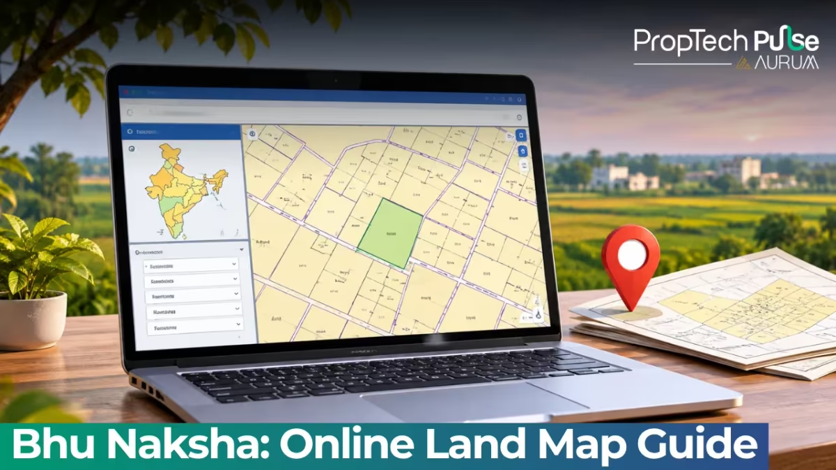
When you are eyeing an agricultural plot or a vacant residential site, the first thing most people skip is checking the underlying cadastral map. Many buyers rely entirely on builder layouts or vague verbal assurances about location.
That approach leaves you vulnerable to encroached boundaries, disputed frontage, or even waterlogged zones hidden from view.
The official government solution exists, and it goes by different names depending on where you look.
Locally, everyone refers to Bhu Naksha when they want to verify a parcel digitally. Pulling up the correct file online takes about five minutes and saves weeks of negotiation headaches later.
What does a Bhu Naksha map show?
Quick answer
A Bhu Naksha map is the official government digital overlay showing village parcel boundaries, Khasra numbers, and land use categories on satellite imagery. You can pull it up for free on state-run .gov.in portals by entering your district, village, and survey number, then exporting the PDF for due diligence.
The term literally translates to "land footprint," but practically speaking, it is the revenue department's authorized digital overlay for every surveyed village.
Before you start learning how to bhu naksha kaise dekhe, you need to know exactly what visual elements sit on that grid.
The base layer consists of satellite photographs or high-resolution scanned field sketches from the Patwari's original records.
Overlaid on top are colored geometric blocks representing individual parcels. Each block carries the exact Khasra number, Khata number, and sometimes a unique survey ID assigned by the state.
You will notice standard color coding that separates agriculture from habitation. Green usually signals cultivable land, while white or grey indicates built-up sites or waste land.
Roadways cut through the grid as bright yellow strips, and existing irrigation canals or seasonal nallas appear as thin blue lines.
Neighboring plots share common boundary lines, which makes it easy to trace adjacent owners without visiting the field first. For context on older terminology, you will often encounter references to traditional units like bigha alongside metric measurements. Understanding these historical units versus modern conversions helps when reading legacy documents attached to the map file.
How to check Bhu Naksha online for your state
Most citizens confuse the central NIC software with the actual viewer used by the public.
The central Bhunaksha portal hosts technical architecture docs and project roadmaps, but you cannot browse village maps there. Every Indian state runs its own frontend server connected to that central database.
That means the URL you type into your browser depends entirely on your location. Searching for a generic "land map online" query often routes you to private real estate aggregators that display outdated stock photos instead of live cadastral layers.
Pulling up your actual plot follows a straight sequence on every state gateway. Start by typing your district code or clicking your district name on the homepage. Select the Mandal or Block next.
Enter the exact village name matching your sale deed. Input the Khasra or Survey number written on the document.
Click search and the system renders the colored polygon over the aerial photo. You can zoom in to check corner stone locations, zoom out to assess proximity to main roads, or export a PDF for your personal records.
Watch out for third-party fees. Official government portals do not charge for viewing or downloading Bhu Naksha maps. Several apps claim to offer 'premium downloads' or paid subscriptions. Ignore those notifications. Stick to the direct URLs provided here to avoid unnecessary costs.
State portal directory (Updated October 2026)
| State | Portal Link | Login / Access Method |
|---|---|---|
| Andhra Pradesh | bhunaksha.ap.gov.in | Meebhoomi integration; enter survey number directly |
| Kerala | emaps.kerala.gov.in | Mobile-friendly web access; select district first |
| Chhattisgarh | bhunaksha.cg.nic.in | Select block and village; view interactive map |
| Madhya Pradesh | mpbhulekh.mp.gov.in | Enter Khasra/Khatauni number via GIS map module |
| Central Portal | bhunaksha.nic.in | Roadmap and framework documentation only; does not serve live public maps |
Notice the domain extensions. They all end in .gov.in or .nic.in, confirming direct government hosting.
Andhra Pradesh merges this directly with Meebhoomi, so residents access plots instantly. Kerala offers a highly optimized mobile version since field visits often happen from smartphones on uneven networks.
Other states host the mapping tools inside broader Bhulekh dashboards. If you are browsing the latest regional guides like the recent jharbhoomi guide 2026 land records bhu naksha guide, you will notice similar state-specific naming conventions. If you already know how to navigate Meebhoomi AP land records including Bhu Naksha, you will find the transition effortless.
Using Bhu Naksha for property due diligence
A cadastral map is powerful because it exposes structural risks long before a sale agreement is signed.
Builders sometimes redraw frontages to maximize selling width, shrinking the interior plot compared to what the Tehsil actually owns. Digital maps prevent that bluff.
Open your phone next to the physical site and compare the drawn polygon with the cement corner stones. If the digital footprint overlaps a neighbor's house or a public drain, walk away immediately.
Real estate fraud relies heavily on buyers trusting paper brochures over verified geospatial data. Cross-referencing this map completes the core of a solid property due diligence checklist.
It also clarifies connectivity promises. A brochure might claim "200 meters from the highway," but a distorted scale can hide the reality.
Switch to satellite view on your state portal. Measure distance against known landmarks like railway tracks or river bends instead of trusting developer drawings. This habit catches zoning violations early.
Industrial belts, airport height restrictions, and forest buffers always show up clearly on the layered map, saving you from buying restricted land.
What to do if the map shows a discrepancy
Gaps between the digital record and ground reality happen frequently. Construction mistakes, unapproved subdivisions, or delayed mutation filings all leave the map lagging behind actual development.
When you spot a mismatch, do not sign the Agreement for Sale yet. Visit the local Village Revenue Officer or Tehsil desk with a printed copy of the map. Request a fresh Demarcation Report or a corrected survey sheet.
Often, the error sits in the old Patta records rather than the new satellite capture, and a simple correction filing fixes it permanently. Checking related frameworks like how Bhu Aadhaar assists buyers reveals extra protection layers available in certain districts.
Final decision rule
If the Bhu Naksha outlines match your physical boundary markers and carry a clean Khasra number, proceed with the financial steps.
Verify the current tax receipts at the Talati office to ensure no dues hang over the account.
Once those checks align, the transaction moves safely forward. Never skip the map step just because the seller pressures you for a quick booking.
Frequently asked questions
Is Bhu Naksha free and official to use?
Yes. Bhu Naksha is a government mapping initiative run by the National Informatics Centre and each state's revenue department. Every portal listed above ends in .gov.in or .nic.in, which confirms its official status. You do not need to pay any fee to view, print, or download the land map PDFs hosted on these servers. Beware of commercial apps that ask you to register before letting you see the plot. They are simply rehosting the same public data behind a paywall.
Can I use the map to find my exact plot size?
The visual layer provides approximate boundaries based on historic surveys, but it rarely gives you an exact square meter count. To get the precise area, you must pull the corresponding Khatauni or Patta extract from the same portal. Revenue documents list the calculated area after accounting for irregular borders, road deductions, and shared pathways. Treat the digital lines as a geographic locator, not a final surveyor's report.
Does Bhu Naksha show the current owner's name?
Not directly on the map canvas. The Bhu Naksha tool focuses exclusively on spatial geometry and parcel numbering. It highlights the Khasra, Khatauni, and Survey numbers overlaid on satellite imagery or scanned field sheets. Ownership names live in separate ledgers like Jamabandi or RTC. You usually need to log into the digitized records section of the same portal to fetch the current registered holder.
How quickly do updates reflect when a plot is subdivided?
Updates depend on the state's digitization speed. Most modern portals refresh monthly once the local Tehsil updates the master database, but lag happens during boundary disputes or pending mutation requests. Subdivision approved last month might still appear as a single block today. Always cross-reference the latest Mutation Register at the Tehsil office before handing over any advance payment.
What should I do if the plot shape looks completely wrong?
Start by checking whether the land falls under a new layout plan or industrial zone, as these shift boundary coordinates significantly. Compare the digital outline with the concrete corner stones you see on site. When the gap is wider than a few meters, request a fresh Demarcation Report from the Village Level Administrator. Discrepancies this large often signal overlapping claims that require legal intervention before purchase.
Sources
- Bhu-Naksha (Indian Cadastral Mapping Solution): Core platform architecture and framework overview (accessed October 2026)
- Bhunaksha Andhra Pradesh: State integration notes and access procedures (accessed October 2026)
- Kerala Bhunaksha eMaps: Mobile web interface testing and district routing (accessed October 2026)
- Bhu-Naksha Chhattisgarh: Georeference and Google Maps integration module (accessed October 2026)
Enjoyed this blog article? Visit PropTech Pulse for more interesting blogs.




Ask Pulse Ai anything about real estate

Unlock the Latest in Real Estate
News, Infographics, Blogs & More! Delivered to your inbox.