New Launch - India Real Estate Report 2026.

Services
Knowledge Hub
Resources
Tools

Ask Pulse Ai
©PropTech Pulse 2025, All rights reserved.


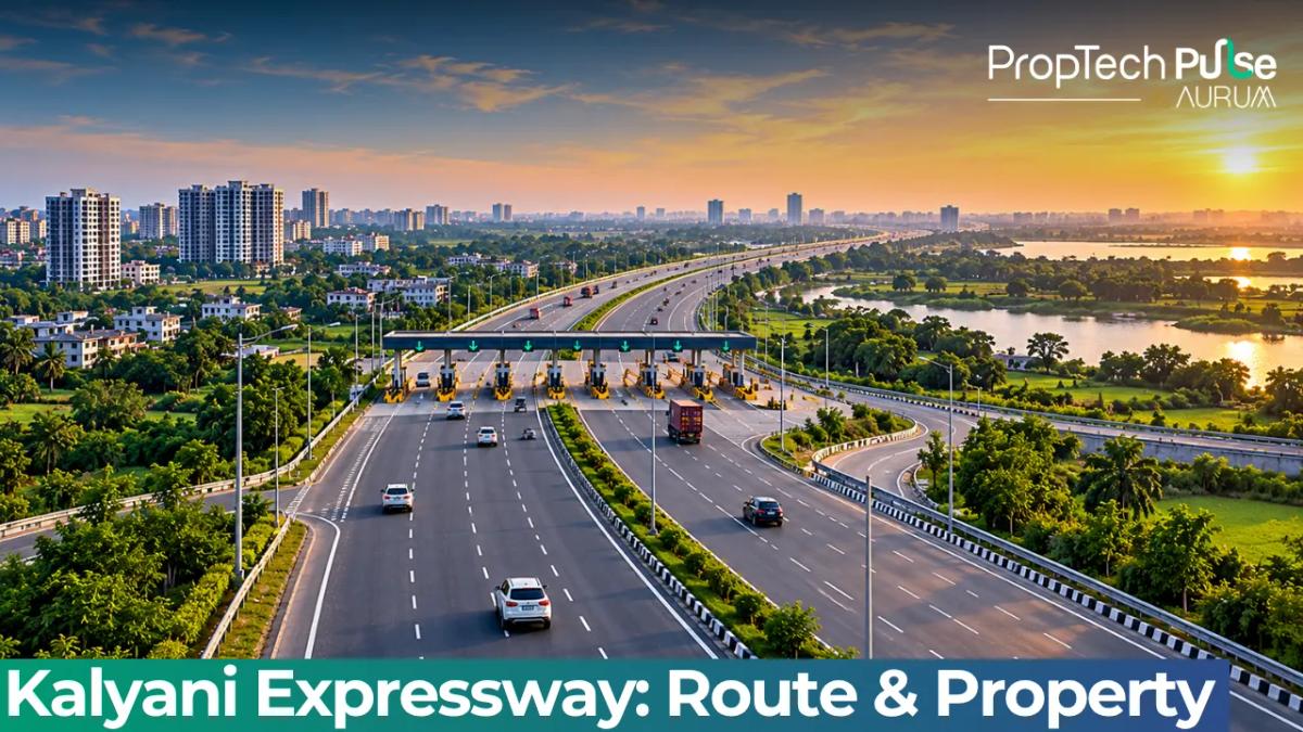
The upgrade of the Kalyani Expressway has changed that equation entirely. Drive times across the forty-four point two-kilometre corridor compress to a manageable forty to forty-five minutes.
Northern suburbs are finally inside the city’s functional daily radius. First-time buyers and investors who previously discounted this belt because of chronic congestion must now reassess valuations, connectivity, and long-term holding strategies.
Kalyani Expressway Route: Mapping the Corridor from Nimta to Bansberia
Quick answer
A forty-four point two-kilometre strategic corridor linking Nimta at the Belghoria Expressway interchange to Bansberia in the Hooghly district. The upgraded infrastructure covers nearly twenty-four kilometres of signal-free driving across twenty-one flyovers and seven underpasses. It reduces the traditional Kolkata to Kalyani commute from roughly two and a half hours to forty to forty-five minutes.
The Kalyani Expressway route spans across North 24 Parganas and extends into Hooghly. It does not simply widen an existing road. The project introduces a grade-separated network designed to handle heavy freight and daily commuter volume without stopping. Construction progressed in distinct segments to minimize disruption during the build phase.
Phase one covers just four point five six five kilometres from Nimta to Muragacha. Phase two continues south-west straight to Kampa. From chainage 35.340, the road snakes past industrial clusters and settled neighbourhoods heading toward Bansberia.
The Zero Point Overpass: Enabling Uninterrupted Access to the Airport via Belghoria Expressway
Zero Point itself carries a colossal concrete ramp stretching one point three to one point five kilometres. Engineers designed this grade separator to swallow the intersection that once gridlocked northbound traffic for hours. It works.
The structure also feeds straight into the Belghoria Expressway. Morning commuters now hold the reins. Surface streets behind Barasat stay choked. The upper decks move freely.
Toll pricing frameworks remain under official review by the West Bengal Home Department Construction Limited. Daily commuters should monitor their website for the finalized slab before signing any lease or purchase agreement.
Kalyani Expressway Property Guide: Which Micro-Markets Are Gaining Value?
Reduced friction between the suburbs and the core city immediately impacts land economics.
When travel time drops from double digits to single digits, willingness to pay for proximity shifts sharply. Looking at current Kalyani Expressway property dynamics, three micro-markets stand out for different reasons.
Kalyani: Capitalizing on AIIMS Kalyani and University Proximity
Located dead centre, Kalyani catches both waves. Better highway access lets professionals based in central Kolkata live here and save thousands monthly.
At the same time, the hospital belt feeding AIIMS Kalyani keeps rental yields tight. Staff, students, and visiting doctors need reliable transit.
Properties within a two-kilometre radius of the Kalyani station and the new flyover ramps are seeing faster absorption rates. Older independent houses and smaller apartment blocks are converting quickly to serviced rentals or family purchases.
Working through these early-stage transactions requires careful document verification, which is covered in our guide on home buying india 2026.
Barrackpore & Kanchrapara: Transitioning from Bedroom Communities to Priority Investments
Barrackpore and Kanchrapara serve different buyer profiles. Barrackpore holds historical weight, industrial heritage, and a strong local community fabric.
Kanchrapara leans commercial, hosting warehouses and small manufacturing units alongside newer gated complexes. Both areas were previously penalized by gridlock.
Now, they offer middle-ground pricing with tangible upside. Commercial plots near the expressway interchanges are attracting logistics operators looking for low-downtime distribution hubs.
Residential buyers chasing space per rupee find ready-to-move inventory that would cost significantly more near the IT corridors of Salt Lake or Sector V.
Barasat & Madhyamgram: Escaping the Historical Traffic Blackholes
Barasat and Madhyamgram mark the transition zone before the Hooghly crossing. Historically, these towns absorbed overflow from a fully saturated Kolkata market, often suffering from poor civic infrastructure.
The Kalyani Expressway bypasses the worst of the surface-level gridlock, pushing development pressure toward the ring road networks. Land banks here remain larger than what you would find closer to the city core.
Investors tracking local municipal expansion plans should watch closely. Supply growth will inevitably trigger a cycle of rate adjustments over the next eighteen to twenty-four months.
Commute Math: How the New 40-Minute Window Changes Your Daily Routine
Start with the wallet. Forty kilometres round-trip usually traps office workers in stop-start conditions for ninety minutes daily. Fuel burns. Time bleeds.
Take the expressway. Traffic flows steady. Travel time drops to sixty minutes. The hidden savings—mental fatigue, vehicle wear, delivered packages—stack up fast.
Petrol bills shrink by eight to ten percent immediately. Those reclaimed hours fund certifications, hobbies, or basic rest.
Property premiums elsewhere absorb the difference. The ribbon markets pay dividends.
| Metric | Old BTR Route (Pre-Upgrade) | New Expressway Route (Current) |
|---|---|---|
| Estimated Travel Time | Two hours to two and a half hours | Forty to forty-five minutes |
| Fuel Consumption Impact | High idle time; 15 to 20% excess burn | Steady speed maintenance; standard consumption |
| Potential Monthly Savings (Petrol) | Baseline spending | ₹1,800 to ₹2,500 less spent |
| Cross-City Transfer Ease | Requires multiple signal stops | Direct merge to Belghoria and airport lanes |
| Overall Practical Viability | Low for daily office commutes | High; absorbs regional overflow efficiently |
A flat priced at sixty-five lakh rupees in Kanchrapara now offers the same practical accessibility as a seventy-five lakh rupee resale in Dum Dum Centre. Factor in lower society maintenance charges and better airflow between blocks.
The reduced drag on your daily schedule translates directly into higher disposable income over a ten-year mortgage period.
Understanding the Kalyani Expressway Extension and Future Projects
The current operational stretch completes the primary trunk line, but urban planners view this as phase one of a broader connectivity push.
The Kalyani Expressway extension plans map a direct artery south-east towards National Highway 12. This linkage ties the corridor into the Kapa-Barajaguli trade route, which traditionally funnels agricultural produce and manufactured goods into the wider national highway grid.
Better freight movement lowers transport overheads for businesses operating out of the northern belt. Higher commercial rents and stronger capital appreciation follow for mixed-use projects built near the junctions.
The Second Ishwar Gupta Setu: What the Cable-Stayed Bridge Adds to Local Accessibility
Structural engineers currently track the progress of the Second Ishwar Gupta Setu, an extradosed cable-stayed bridge designed to cross the Hooghly River parallel to the existing Howrah Bridge.
This superstructure will not replace the older crossings. It will divert heavy vehicles away from the city centre during peak hours.
Once fully commissioned, the setu will sync perfectly with the expressway’s southern terminus at Bansberia. The combined effect cuts cross-city transit time by up to thirty minutes for anyone living beyond the river.
Local developers are already adjusting master plans to incorporate larger footprints near the projected landing zone. Major developers active in the region are listed in our roundup of top 10 real estate companies in kolkata 2026.
Before You Lock in a Property Purchase Along the Northern Belt
The Kalyani Expressway upgrade removes the biggest barrier to entry for this region. That does not mean every project suddenly qualifies as a blue-chip investment.
Verify registration status for every tower using the official West Bengal registry. Review the approved building footprint against municipal layouts, and run your personal numbers through a transparent EMI tracker.
Calculate the exact stamp duty burden upfront rather than guessing. If the location matches your daily workplace, school catchments, and future exit strategy, the new timeline makes the northern belt viable.
Purely speculative buyers should wait for the second wave of infrastructure completions to stabilize rates before committing capital.
Frequently asked questions
What is the new travel time from Kolkata to Kalyani via the expressway?
The upgraded corridor compresses the traditional journey to forty to forty-five minutes. The previous surface-road commute typically required over two hours due to repeated signals and heavy freight mixing with passenger vehicles. The new grade-separated design eliminates most stopping points, making the trip predictable for daily professionals.
Where does the kalyani expressway start and end?
It begins at Nimta, connecting directly to the Belghoria Expressway and NH-19. The route stretches through Sodepur, Barrackpore, and Kanchrapara before terminating near Bansberia in the Hooghly district. The total mapped length covers approximately 44.2 kilometres across North 24 Parganas and Hooghly.
Is there a toll charge on the expressway right now?
Official slab rates are still pending final notification from the West Bengal government. The construction concessionaire is expected to publish the exact per-kilometre charges once the regulatory committee approves the final tariff structure. Watch the department portal for updates before budgeting for regular usage.
How does the expressway improve connectivity to AIIMS Kalyani and the airport?
The corridor runs parallel to the medical green zone feeding AIIMS Kalyani, giving patients and hospital staff reliable bypass routes during emergencies. At the northern end, the Zero Point elevated structure merges straight into the airport-bound Belghoria Expressway, removing the historic Barasat bottleneck that previously blocked outbound flights.
What is the kalyani expressway extension timeline to NH-12?
Phase two planning targets a direct connection to National Highway 12 via the Kapa-Barajaguli corridor. Construction timelines depend on land acquisition clearances and funding disbursements from the state finance ministry. Early stage surveys indicate activity could begin within the next twelve months once environmental assessments close.
Sources
- West Bengal Home Department Construction Limited (WBHDCL): Project specifications, phase boundaries, toll framework status, and maintenance timeline (accessed October 2026)
Enjoyed this blog article? Visit PropTech Pulse for more interesting blogs.





Ask Pulse Ai anything about real estate

Unlock the Latest in Real Estate
News, Infographics, Blogs & More! Delivered to your inbox.